
Hike along the Petit Balcon Nord: Le Tour-Argentière
Chamonix-Mont-Blanc > Chamonix-Mont-Blanc


Place du Tour
74400 Chamonix-Mont-Blanc
Departure altitude: 1464 m
133 Chemin de la Moraine
74400 Chamonix-Mont-Blanc
Arrival altitude: 1261 m
Take the Rocher Nay path, leave the Bisme path on the right that goes down to Montroc
to Montroc and cross the Bisme bridge. Take the slightly ascending path in front of you
through a beautiful forest leaving successively on the left the paths of
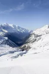
the paths of Pécleret and Grand-Chantet on the left. Nice view on the Tour and Montroc.
Continue downhill to arrive, in the middle of the larches, above the
the hamlet of Planet. Leave the paths on the left and right and take the path in front of you, reach the bottom of the moraine then continue on the right by the paths of Rambles and Moraine to reach Argentière.
More information is available at the Tourist Office or the Office de Haute-Montagne and in our trail guide.
Warning: Trail conditions are subject to change, so be sure to check before you leave.
Your contact
Office de Tourisme de Chamonix85 place du triangle de l'amitié
74400 Chamonix-Mont-Blanc
On the itinerary

Positive elevation (ascent): 71 m
Negative elevation (descent): 276 m
Road surfaces
229 m on asphalt or tarred road
297 m on unknown surface in the Open Street Map database
176 m on rolling path (compacted sand, gravel, cobblestones)
2.88 km on trail and off-road track
Find this route on the Loopi mobile app
Scan the QR code, save it as a favorite, or start the guidance, just enjoy!


Scan the QR code, save it as a favorite, or start the guidance, just enjoy!
This route is provided by: Office de Tourisme de la Vallée de Chamonix-Mont-Blanc
Be cautious and prepared during your outings. Loopi and the author of this sheet cannot be held responsible for any problems that occur on this route.