Fermer
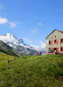
Accommodation
Useful information
Leasure
Restaurants/bars
Zones protégées
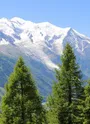
Routes
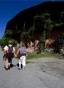
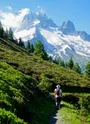
Walk
By bike
65 routes
All filters
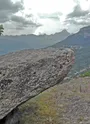
The Granite Path
1.90 km · 1 h 30 min
Easy
Hike to the refuge of Albert 1er from the Col de Balme
8.00 km · 3 h 15 min
Difficult
La Pierre à Bérard
10.4 km · 3 h 30 min
Difficult
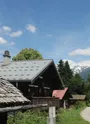
The Chemin des Villages walk
3.20 km · 1 h
Very easy
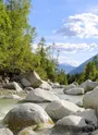
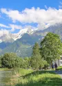
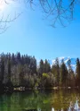
Along the Arve river
2.30 km · 1 h 30 min
Very easy
Hiking to la Flégère from Chamonix
8.00 km · 4 h 10 min
Difficult
Chamonix > Bel-Lachat hiking trail
11.6 km · 5 h 40 min
Difficult
Hiking to the Pyramids viewpoint
8.20 km · 4 h
Average
Pedestrian track of Les Chavants
1.62 km · 0
Very easy
Hike along the Petit Balcon Nord: Le Tour-Argentière
3.40 km · 1 h
Easy
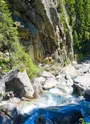
Hike to Le Dard waterfall
6.60 km · 1 h 45 min
Average
A walk to Château Saint Michel
2.20 km · 2 h
Easy
Hike to the Pormenaz Alpine pasture and Lac de Pormenaz
14.8 km · 6 h
Difficult
Aiguillette d'Argentière hiking
8.00 km · 2 h 30 min
Average
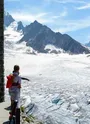
Hike to the Chalet du glacier des Bossons
2.60 km · 1 h 20 min
Easy
The Tré-les-Eaux Valley
4.70 km · 5 h 15 min
Difficult
Tour of Mont-Blanc in 6 days
80.0 km · 0
Difficult
Pierre à Bosson hiking
4.00 km · 1 h 40 min
Average
Hike to Caillet
3.20 km · 3 h
Average
Hike to the Lac Blanc from la Flégère
7.00 km · 3 h
Difficult
Hike to Charousse
1.80 km · 2 h
Average
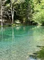
Les Sources de l'Arveyron walk
4.00 km · 1 h
Very easy
Hike to the Chapeau viewpoint from les Tines
5.30 km · 2 h 40 min
Average
Vallorcine village pedestrian itinerary
3.60 km · 2 h
Hike to the mountain pasture of Blaitière - Dessous
5.90 km · 3 h 30 min
Average
Hike to Lac Blanc from Col des Montets
9.40 km · 5 h
Difficult
Hike to Rochers des Mottets
9.00 km · 3 h 30 min
Average
Moraine d'Argentière walk
3.00 km · 45 min
Very easy
Les Gens > Arandellys > Bellevue > Les Trabets trail
11.0 km · 5 h
Hike to the Alpage of Chailloux
6.20 km · 3 h 45 min
Difficult
Bérard waterfall trail
1.80 km · 50 min
Easy
Hike along the Petit Balcon Nord: Argentière-Les Bois
6.00 km · 1 h 45 min
Easy
Charme pasture trails
3.50 km · 1 h 15 min
Grand Balcon Nord: Plan de l'Aiguille du Midi-Montenvers
5.70 km · 2 h 30 min
Average
The Barberine Waterfall trail
3.60 km · 1 h 30 min
Easy
Hike to the Lac Cornu from the Planpraz cable car
7.00 km · 3 h 30 min
Difficult
Chamonix-Plan de l'Aiguille hiking trail
14.0 km · 5 h 30 min
Difficult
Argentière > Lac des Cheserys hiking trail
9.60 km · 5 h
Average
Aiguillette des Houches par Alpages de Chailloux
9.80 km · 4 h
Difficult
Lac Bleu from Plan de l'Aiguille hiking
1.30 km · 1 h
Average
Bellevue - Bionnassay glacier trail via the Chalets de l'Are
2.40 km · 4 h 30 min
Difficult
The Alpine Pastures of Blaitière Dessous and Dessus
9.20 km · 5 h
Average
Hike to Paradis des Praz
3.00 km · 1 h
Very easy
Hike along the Petit Balcon Sud: Argentière-Les Tines
3.80 km · 1 h 15 min
Easy
Coupeau > Servoz trail
10.0 km · 3 h
Average
The Gures trail
2.60 km · 2 h
Easy
Hike to La Floria
4.20 km · 1 h 45 min
Average
Lac Vert hiking trail
2.40 km · 1 h 35 min
Easy
Grand Balcon Nord: Bellevue to Prarion
3.30 km · 2 h
Average
The "Trois Gouilles" trail
2.50 km · 2 h
Easy
Hiking to Planpraz from Chamonix
9.40 km · 5 h
Difficult
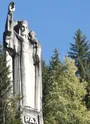
Hike to the Christ-the-King statue
3.80 km · 1 h 10 min
Easy
Péclerey hiking trail
6.70 km · 3 h 20 min
Difficult
Hike to Col de Balme from Charamillon cable car
3.80 km · 2 h
Average
The Tête de la Fontaine hiking trail
1.80 km · 2 h
Easy
Hike to Lac Blanc from the Index cable car
2.90 km · 2 h 45 min
Average
Hike along the Petit Balcon Sud: Les Bossons-Merlet
2.70 km · 1 h 30 min
Average
Hike to Aiguillette des Posettes
7.00 km · 4 h 15 min
Average
Le Chemin des Diligences
8.60 km · 3 h 30 min
Very easy
Hike along the Petit Balcon Sud: Les Tines-Les Bossons
10.1 km · 3 h
Easy
High South Balcony : Flégère - Planpraz
5.50 km · 2 h
Average
Classic 12-day Tour of Mont Blanc
165 km · 0
Difficult
Alpage de Loriaz from Le Couteray
8.20 km · 4 h 10 min
Difficult
Hike to Le Cerro
2.10 km · 1 h
Easy
Hiking trail from Les Chavants to Col de la Forclaz via Charousse
9.60 km · 2 h 40 min
Average
Map
Clear
OK
City
City
Chamonix-Mont-Blanc
Les Contamines-Montjoie
Les Houches
Megève
Passy
Saint-Gervais-les-Bains
Servoz
Vallorcine
Route type
All
Aller simple
Boucle
Elevation
All
< 200m
Entre 200m et 500m
Entre 500m et 1000m
Entre 1000m et 3000m
> 3000m
Duration
All
Jusqu'à 1 h
Entre 1h et 2h
Entre 2h et 4h
Entre 4h et 6h
Plus de 6 h
Difficulty
All
Very easy
Easy
Average
Difficult
Accueil
Parcours
Se déplacer
Explorer