
The Gures trail
Servoz > Passy
© OT Vallée de Chamonix MB

© OT Vallée de Chamonix MB

© OT Vallée de Chamonix MB

© OT Vallée de Chamonix MB

© OT Vallée de Chamonix MB

© OT Vallée de Chamonix MB

© OT Vallée de Chamonix MB

© OT Vallée de Chamonix MB

© OT Vallée de Chamonix MB

© OT Vallée de Chamonix MB

© OT Vallée de Chamonix MB

© OT Vallée de Chamonix MB

© OT Vallée de Chamonix MB

8 Route du pont des lanternes
74310 Servoz
Departure altitude: 818 m
460 Chemin de Montcoutant
74190 Passy
Arrival altitude: 935 m
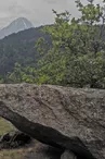
Departure by the Vieux Servoz. Go towards Le Châtelard: after the Pont des Lanternes, take the first path on the right that goes up the side of the Gures massif. On the plateau, in the vegetation, go through the camp and discover the testimonies of shelter, of defense or of habitat of people : Allobroges, Ceutrons,... Notice the Stone of the Sacrifice, the Dolmen of Laby, the Table... A Roman gallery, not very visible, is located near the road tunnel going up.
Notes. A path, the Berges de l'Arve rive droite, goes from the Pont des Lanternes to the Pont de l'Avenue (1h30).
More information available at the Tourist Office or the High Mountain Office and in our trail guide.
Attention : The conditions of the trails are likely to change, think to inquire before leaving.
Your contact
Office de Tourisme de Chamonix85 place du triangle de l'amitié
74400 Chamonix-Mont-Blanc
On the itinerary
Positive elevation (ascent): 107 m
Negative elevation (descent): 0 m
Road surfaces
457 m on unknown surface in the Open Street Map database
976 m on trail and off-road track
Find this route on the Loopi mobile app
Scan the QR code, save it as a favorite, or start the guidance, just enjoy!


Scan the QR code, save it as a favorite, or start the guidance, just enjoy!
This route is provided by: Office de Tourisme de la Vallée de Chamonix-Mont-Blanc
Be cautious and prepared during your outings. Loopi and the author of this sheet cannot be held responsible for any problems that occur on this route.