
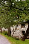
The Barberine Waterfall trail
Vallorcine > Vallorcine
© SMB

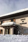
© ot Vallorcine

582 Route de l'Église
74660 Vallorcine
Departure altitude: 1248 m
Chemin de la Cascade
74660 Vallorcine
Arrival altitude: 1300 m
At the end of the village, in the hamlet of Mollard, a path goes through the meadows and becomes a trail.
After the Nant du Rand (small stream), stay on the upper path that crosses the hillside: it joins the one coming from Barberine and goes up towards the stream where the waterfall is.
Return : by the same itinerary, through the village of Barberine, going down
about 100 m on the RD1506, then going up to the right in a clearing.
A few steps near the oratory allow you to pass over the tunnel
the tunnel of the SNCF track and to join the path of the Black Water which goes up on the right to
Vallorcine.
Notes : Interesting visit of the Maison de Barberine (Vallorcin museum), open in July and August, located at the exit of the village on the RD1506 side
More information available at the Tourist Office or the Office de Haute-Montagne and in our trail guide.
Attention : The conditions of the trails are likely to change, think of informing you before leaving.
Your contact
Office de Tourisme de Chamonix85 place du triangle de l'amitié
74400 Chamonix-Mont-Blanc
On the itinerary


Positive elevation (ascent): 78 m
Negative elevation (descent): 23 m
Road surfaces
212 m on asphalt or tarred road
8 m on unknown surface in the Open Street Map database
51 m on rolling path (compacted sand, gravel, cobblestones)
1.99 km on trail and off-road track
Find this route on the Loopi mobile app
Scan the QR code, save it as a favorite, or start the guidance, just enjoy!


Scan the QR code, save it as a favorite, or start the guidance, just enjoy!
This route is provided by: Office de Tourisme de la Vallée de Chamonix-Mont-Blanc
Be cautious and prepared during your outings. Loopi and the author of this sheet cannot be held responsible for any problems that occur on this route.