
The Chemin des Villages walk
Les Houches > Les Houches
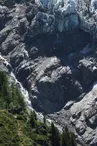
© A. Juillet

55 Avenue des Alpages
74310 Les Houches
Departure altitude: 1006 m
2150 Avenue des Alpages
74310 Les Houches
Arrival altitude: 1003 m
From the skating rink, go up Chemin des Longues, then turn left onto Chemin de la Tannuaz. Follow the Griaz road up to Chemin des Fleurs. Cross over to chemin du Platon, then downhill a few meters on route des Granges before forking right onto chemin Théobalde Couttet. Take the footbridge and follow the path to the hamlet of Pont. Follow the signs for Chemin des Villages / Taconnaz. Total distance: approx. 2.5km.
From Taconnaz, you can join another itinerary to extend your walk to Les Bossons, then to Les Gaillands, and finally to the entrance to Chamonix.
Your contact
Office de Tourisme de Chamonix85 place du triangle de l'amitié
74400 Chamonix-Mont-Blanc
On the itinerary
Positive elevation (ascent): 60 m
Negative elevation (descent): 64 m
Road surfaces
795 m on asphalt or tarred road
2.06 km on unknown surface in the Open Street Map database
393 m on trail and off-road track
Find this route on the Loopi mobile app
Scan the QR code, save it as a favorite, or start the guidance, just enjoy!


Scan the QR code, save it as a favorite, or start the guidance, just enjoy!
This route is provided by: Office de Tourisme de la Vallée de Chamonix-Mont-Blanc
Be cautious and prepared during your outings. Loopi and the author of this sheet cannot be held responsible for any problems that occur on this route.