
Péclerey hiking trail
Chamonix-Mont-Blanc > Chamonix-Mont-Blanc
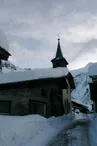
© OT Chamonix

© OT Chamonix

579 Chemin du Planet
74400 Chamonix-Mont-Blanc
Departure altitude: 1386 m
579 Chemin du Planet
74400 Chamonix-Mont-Blanc
Arrival altitude: 1385 m
From the village of Le Tour, take the path of Rocher Nay, leave on the right the path of Bisme which goes down to Montroc and cross the bridge of Bisme. Take the Petit Balcon, slightly ascending in the forest, leaving on the left the path of the return of Péclerey. In a corridor, leave the Petit Balcon and go up on the left by a path that leads to the fork where you join the path of Planet and Argentière. Continue up to the left by a long traverse: the larch forest is splendid. Many twists and turns over 250m of difference in level lead to the top of the forest. Cross to the left and descend slightly to the slab shelter under the Tête du Grand Chantet.
More information is available at the Tourist Office or the Office de Haute-Montagne and in our trail guide.
Warning: Trail conditions are subject to change, so be sure to check before you leave.
Your contact
Office de Tourisme de Chamonix85 place du triangle de l'amitié
74400 Chamonix-Mont-Blanc
On the itinerary
Positive elevation (ascent): 602 m
Negative elevation (descent): 593 m
Road surfaces
1.77 km on unknown surface in the Open Street Map database
6.09 km on trail and off-road track
Find this route on the Loopi mobile app
Scan the QR code, save it as a favorite, or start the guidance, just enjoy!


Scan the QR code, save it as a favorite, or start the guidance, just enjoy!
This route is provided by: Office de Tourisme de la Vallée de Chamonix-Mont-Blanc
Be cautious and prepared during your outings. Loopi and the author of this sheet cannot be held responsible for any problems that occur on this route.