
Hiking to la Flégère from Chamonix
Chamonix-Mont-Blanc > Chamonix-Mont-Blanc
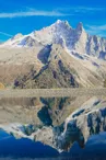
© OTVCMB_SA

© OTVCMB_SA

300 Route des Nants
74400 Chamonix-Mont-Blanc
Departure altitude: 1065 m
Retour Via Ferrata
74400 Chamonix-Mont-Blanc
Arrival altitude: 1868 m
Follow the signs for the Floria from the route des Nants. Once at the refreshment bar, continue on the path that climbs slightly and cross the Couloir des Lanchers. Stay continuously on the left side of the cable car and pass the Praz des Violles. The path crosses, then uses the ski run to reach the Flégère located above the Cornua forest.
Departure also possible from Les Praz or Les Tines.
More information available at the Tourist Office or the High Mountain Office and in our trail guide.
Attention : The conditions of the trails are likely to change, think of informing you before leaving.
Your contact
Office de Tourisme de Chamonix85 place du triangle de l'amitié
74400 Chamonix-Mont-Blanc
On the itinerary
Positive elevation (ascent): 802 m
Negative elevation (descent): 0 m
Road surfaces
2.09 km on unknown surface in the Open Street Map database
4.20 km on trail and off-road track
Find this route on the Loopi mobile app
Scan the QR code, save it as a favorite, or start the guidance, just enjoy!


Scan the QR code, save it as a favorite, or start the guidance, just enjoy!
This route is provided by: Office de Tourisme de la Vallée de Chamonix-Mont-Blanc
Be cautious and prepared during your outings. Loopi and the author of this sheet cannot be held responsible for any problems that occur on this route.