
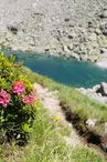
Lac Bleu from Plan de l'Aiguille hiking
Chamonix-Mont-Blanc > Chamonix-Mont-Blanc
© OTVCMB_SA

© OTVCMB_SA

© OTVCMB_SA

Accès Zone de Décollage des Parapentes
74400 Chamonix-Mont-Blanc
Departure altitude: 2300 m
Accès Zone de Décollage des Parapentes
74400 Chamonix-Mont-Blanc
Arrival altitude: 2298 m
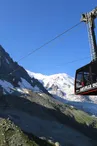
Departure from the cable car station of Plan de l'Aiguille, then left tendency, continue for a few moments: the lake suddenly appears to the eyes of the walkers.
More information available at the Tourist Office or the High Mountain Office and in our trail guide.
Warning: Trail conditions are subject to change, so be sure to check before you leave.
Your contact
Office de Tourisme de Chamonix85 place du triangle de l'amitié
74400 Chamonix-Mont-Blanc
On the itinerary
Positive elevation (ascent): 31 m
Negative elevation (descent): 28 m
Show slopes on the mapSlopes measured over 500 m
Slope breakdown
Flat (-5 % to 5 %)1.29 km · 100 %
Road surfaces
Trail and off-road track1.37 km · 100 %
Find this route on the Loopi mobile app
Scan the QR code, save it as a favorite, or start the guidance, just enjoy!


Scan the QR code, save it as a favorite, or start the guidance, just enjoy!
This route is provided by: Office de Tourisme de la Vallée de Chamonix-Mont-Blanc
Be cautious and prepared during your outings. Loopi and the author of this sheet cannot be held responsible for any problems that occur on this route.