
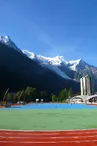
MTB trail - G : Chamonix - Argentière via the Arve river's right bank
Chamonix-Mont-Blanc > Chamonix-Mont-Blanc
© Monica Dalmasso

99 Avenue de la Plage
74400 Chamonix-Mont-Blanc
Departure altitude: 1039 m
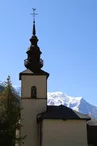
98 Route du Village
74400 Chamonix-Mont-Blanc
Arrival altitude: 1255 m
Possibility to do the course in the direction Argentière - Chamonix : D+ 70 m.
Wearing a helmet and protective gear is highly recommended. Mountain bikes suitable for downhill riding with appropriate braking systems.
Mountain bike guide available at all rental companies in the valley and at the Tourist Offices.
Your contact
Office de Tourisme de Chamonix85 place du triangle de l'amitié
74400 Chamonix-Mont-Blanc
On the itinerary
Positive elevation (ascent): 208 m
Negative elevation (descent): 0 m
Route development
87% shared roads
12% cycle paths
Road surfaces
2.30 km on asphalt or tarred road
1.76 km on unknown surface in the Open Street Map database
265 m on rolling path (compacted sand, gravel, cobblestones)
4.70 km on trail and off-road track
Find this route on the Loopi mobile app
Scan the QR code, save it as a favorite, or start the guidance, just enjoy!


Scan the QR code, save it as a favorite, or start the guidance, just enjoy!
This route is provided by: Office de Tourisme de la Vallée de Chamonix-Mont-Blanc
Be cautious and prepared during your outings. Loopi and the author of this sheet cannot be held responsible for any problems that occur on this route.