
Hike to Aiguillette des Posettes
Chamonix-Mont-Blanc > Vallorcine
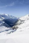
© OT Vallée de Chamonix Mont Blanc

© OT Vallée de Chamonix Mont Blanc

© OT Vallée de Chamonix Mont Blanc

© OT Vallée de Chamonix Mont Blanc

© OT Vallée de Chamonix Mont Blanc

© OT Vallée de Chamonix Mont Blanc

236 Place du Tour
74400 Chamonix-Mont-Blanc
Departure altitude: 1485 m
250 Chemin du Quieset
74660 Vallorcine
Arrival altitude: 2172 m
Near the bridge on the right bank of the Arve, take the path facing the slope. It splits in two
in two: go to the right in a small forest that quickly becomes clearer. Above the Tête de la Jorette, after many twists and turns, the path reaches the crossroads of the Pierre-Fendue (1,950 m): go up to the right, notice the paravalanches, reach the abandoned slate quarries, then the ridge that leads to the Aiguillette.
Another possible itinerary from the Col des Posettes at the arrival of the Vallorcine Télécabine. Pay attention to the opening dates!
More information available at the Tourist Office or the High Mountain Office and in our trail guide.
Warning: Trail conditions are subject to change, so please check before you leave.
Your contact
Office de Tourisme de Chamonix85 place du triangle de l'amitié
74400 Chamonix-Mont-Blanc
On the itinerary

Positive elevation (ascent): 688 m
Negative elevation (descent): 0 m
Road surfaces
44 m on asphalt or tarred road
683 m on unknown surface in the Open Street Map database
1.76 km on rolling path (compacted sand, gravel, cobblestones)
1.42 km on trail and off-road track
Find this route on the Loopi mobile app
Scan the QR code, save it as a favorite, or start the guidance, just enjoy!


Scan the QR code, save it as a favorite, or start the guidance, just enjoy!
This route is provided by: Office de Tourisme de la Vallée de Chamonix-Mont-Blanc
Be cautious and prepared during your outings. Loopi and the author of this sheet cannot be held responsible for any problems that occur on this route.